
News
Cambridge Residents Slam Council Proposal to Delay Bike Lane Construction
News
‘Gender-Affirming Slay Fest’: Harvard College QSA Hosts Annual Queer Prom

News
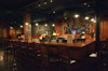
‘Not Being Nerds’: Harvard Students Dance to Tinashe at Yardfest

News
Wrongful Death Trial Against CAMHS Employee Over 2015 Student Suicide To Begin Tuesday

News
Cornel West, Harvard Affiliates Call for University to Divest from ‘Israeli Apartheid’ at Rally
J. E. Wolf Describes Trip to Vicinity of Mt. Whitney in the Sierra Nevadas
Professor of Mineralogy Emeritus Tells of Fishing and Other Adventures
The following article, reprinted in part from the Harvard Alumni Bulletin and written by Professor J. E. Wolf '79, Professor of Petrology and Mineralogy Emeritus, describes an interesting visit which he recently made in the company of T. R. Gaines of Pasadena to the vicinity of Mt. Whitney, one of the Sierra Nevada range.
Mt. Whitney, whose altitude is 14,502 feet, was seen first in 1864 by two assistants of Professor Whitney whose name the mountain bears as a permanent memorial to the man who labored so many years to map the topography and geology of this almost unknown country.
"Toward evening," says Professor Wolf after describing his trip from Pasadena, "we arrived by motor at our first camp from which our actual expedition was to set out. Early the next morning we left the car and with an excellent packer-guide, saddle horses, and two pack mules, we continued up the narrow canyon of Cottonwood Creek, a roaring mountain torrent heading in numerous lakes under Mt. Langley. The trail wound steeply up between pine trees and rocks for nine miles, when we emerged from the canyon onto a sloping plateau at about 10,000 feet elevation, where the stream ran gently through pine forests and meadows and was followed six miles further to our camp at one of the lakes under Mt. Langley, which is five miles along the crest south of Whitney.
The next day we rode a trail which climbs to a gap at the southern end of Langley ridge called Army Pass, and so on to the head of Rock Creek, a tributary of the Kern River, which itself finally reaches the San Joaquin valley at Bakersfield. Emerging into the pass, we came out on a broad granite plateau sloping gently west, an abrupt change from the tremendous cliffs skirted by the trail coming up from the east, and soon descended to first water and timber line, following Rock Creek down to 9,500 feet, three miles above its final plunge into the tremendous canyon of the Kern. The rocky trail led through forests of lodge-pole pines, over rocky spurs and boulders, and through occasional lovely glades.
Leaving Rock Creek, we turned north, climbing 1,000 feet by many of Mt. Guyot, and came to a gap at steep zig zags and skirting the east base 11,000 feet. Then, passing over flat areas covered with granite sand and huge pine, we came down to Crabtree Meadows, on the creek of the same name.
This, we followed up some miles, riding over successive roches moutonnees to one of the upper likes, where we found an excellent base camp, with wood, water, and good feed for the stock, and my companions quickly got out their fishing gear and started for the golden trout.
The third day we rode some four miles upstream to one of the highest lakes. We left the stock at the lake, to feed on the meadow, and, following the trail on foot to 12,000 feet, entered the "chimney"a narrow cleft in the granite, some 150 feet wide, which extends straight up the slope for 1,000 or so feet and enables one to get through the cliffs to the upper final slope of the crest, some distance south of the summit.
Mt. Langley a Strenuous Climb
There is a trail of a sort, or rather a choice of many trails, meandering over the low ledges, boulders, and sand of the chimney; it is strenuous climbing in places, but perfectly safe, and one finally emerges on the gentler and smoother upper crest and soon joins a better trail coming from Lone Pine, north of Owen's Lake, crossing the crest at Whitney Pass, and following just below the rim north to the reak, passable for horses when the snow is not took deep in some of the gulches. From here it was a short and easy climb to the top of Mount Langley.
The summit is a broad, gently-curving dome of white granite, with many large blocks loosened by the weather, and, until one approached the edge and looked down to the base of the tremendous vertical cliffs, all seemed gentle and smiling, for we had a warm, still day. The next day it snowed and visitors were peevish. The view, of course, is immense--peaks on peaks for hundreds of miles, forests and valleys, lakes and streams.
The nearby peaks of the Whitney group bear mostly the names of geologists, explorers, and other men of science (Whitney, Langley, Muir, Hitchcock, Guyot, Russell, Leconte, Tyndall, etc.), while our great peaks in southern California have "saint" names, (San Antonio, San Gorgonio, San Jacinto, San Gabriel, etc.)--Anglo-Saxon and Spanish contrasted, or science and religion, if you like. However, we have a Devil's Punch-bowl across the range from Pasadena.
Mt. Langley illustrates the dissected dome feature already mentioned. This old summit level is, I suppose, and old plane of erosion, later uplifted, and the dissection guided by the dominant structures of the granite, which includes two vertical planes of easy splitting and, much less marked, a curving horizontal plane of weakness. The weather works into the vertical plane and splits off great blocks, which, falling, form the immense masses at the foot of the cliffs and thus originate the tremendous precipices and great jags of the crest, like splinters set on edge.
Ice 500 Feet Thick
There was little snow to be seen, because of the small precipitation in recent winters, but the extinct glciation more than compensated. On both sides of the Whitney group, glaciers formed in the cirques under the peaks and flowed down east and west, but in greater volume westward, facing the Pacific. Every stream has a chain of glacial lakes at the head, and between them, as the ice and its rock burden moved down, it carved and gouged and polished the granite in typical glacial forms; a couple of miles below. Whitney on Crabtree Creek a casual estimate of the thickness of the ice gave 500 feet.
This pseudo-technical description may joyfully pass to the fishing for which the Whitney region is famous. Every stream and lake on both sides of Whitney, Langley, etc., has a species, or variety, of trout known as "golden trout." I have seen the trout and eaten them, but, being no fisherman, can only repeat what others say and thus escape approbrium, namely that they are found nowhere in the Sierras except in this limited locality and that attempts to transplant the spawn to other places do not produce the same fish. Again experts tell me they are simply rainbow trout, modified by the environment, and hence they change back.
Trout Are Beautiful
Whatever their true nature they are a beautiful fish, yellow and black, and seemed to me more substantial food than the ordinary trout. They vary in length; our guide said he had seen one 28 inches long, but our party had to be satisfied with six or seven inches, although they saw many big ones. At our last camp on lower Rock Creek the guide caught his limit (twenty fish) and gave them to us to take back to Pasadena. He cleaned them, hung them up for the night to dry, packed them in canvas, and then inside a roll of pedding which we were not to open until the fish were to be eaten. They were carried two days on mules, one day through the heat of the desert, and cooked and eaten in Pasadena, perfectly good. "Ed", the packer, sneered at ice, and said he would show us something better, which he certainly did.
We went back from Rock Creek by another trail, south of our entrance, crossed a high interstream divide, called Siberian Pass, down to Whitney Meadows at the head of Golden Trout Creek, over the crest at Cottonwood Pass, down a tributary to Cottonwood Canyon, and so to our first camp, a circuit of about 100 miles in six days. The next day, we started at 5 o'clock. Deducting the time taken or towing a disabled car from the mountain road, and for breakfast, we made the 217 miles in seven and one-half hours. This time prompts a comparison between Professor Whitney and his sides in the sixties and the present. We travelled five of the eight days on horseback over good trails, one day afoot, and 434 miles by auto in two short days!
Mt. Whitney Not Climbed Until 1873
Mt. Whitney, though seen and named in 1864, was not climbed until 1873, and no wonder! Now hundreds of people--men, women, and older children--climb it every summer and fish and camp; we passed hunting parties going in for the deer season, September 1, but the country is so immense we met few on the trails. Some young people, ror economy, hire a pack-mule and walk, but the trails are steep and often dusty, so that a horse is a necessity for real pleasure. Our horses were mountain bred, sure-footed, and gentle. We estimated the cost for the six days at about $50 each, including food, horses, etc. Nature provided fuel, water, and light, thus giving the meters at home a rest. We lived on simple food of our own cooking, with trout provided, and agreed that it was cheaper than staying at home.
Want to keep up with breaking news? Subscribe to our email newsletter.